Day 46, Sunday, 6/3/18
High River, AB
We left Jasper and headed down the Icefields Parkway. About 20 miles south of Jasper we stopped to see Athabasca Falls, a class 5 waterfall on the Athabasca River. The falls sends a huge amount of water over its 60 foot drop, carving a gorge and numerous potholes in the softer limestone it travels over.

Athabasca Falls

Looking into the Gorge

The Gorge

Another View of the Gorge

Pothole

The Falls
The falls are a tourist attraction and when we pulled into the parking lot there were at least 3 buses with people wandering everywhere. As we walked back to the van, there was a cluster of people looking into some trees, pointing and snapping pictures. Thinking they were looking at something interesting, we joined the crowd where a woman turned to us, finger on mouth, 'shush'. We couldn't see what it was that had the crowd so enthralled until someone moved a bit and we spotted the culprit - a red squirrel.
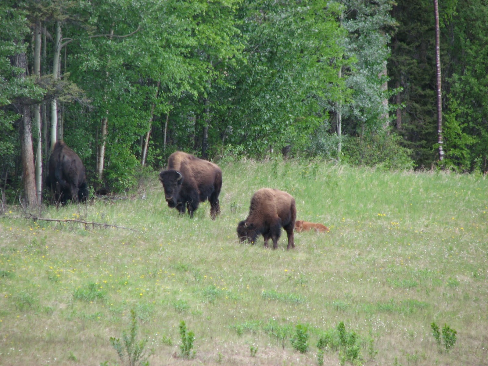
Back on the road, we spotted 2 black bears, one sauntering nonchalantly across the road.


Folded Mountains
The Icefield Parkway is spectacular. On our way north, it was snow and ice. Four weeks later, it's spring with lots of green! Heading south, we saw what we missed on our way north - this a result of not having eyes on the back of our head! About 13 miles from Athabasca Falls, the road heads east and picks up the Sunwapta River where we stopped to enjoy the Sunwapta Falls. The source of the Sunwapta River is the Athabasca glacier, part of the Columbia Icefields. The icefields are the largest mass of ice in the Rockies stretching about 16 miles across the continental divide. The divide is a triple divide because the waters from the glaciers and melting snow flow into 3 drainages: north to the Arctic, west to the Pacific and east to the Atlantic.
There are six glaciers making up the Columbia Icefield, three of which can be seen from the road: Stutfield, Athabasca and Dome.

Stutfield

Athabasca

Dome
The Athabasca is one of the most easily accessed glaciers around, right off the Icefields Parkway road. Because of this, the area has become heavily commercialized.
As we headed south we passed Bow Lake and Crowfoot Mountain, each with a view of a glacier. Bow and Crowfoot glaciers are small, each steadily retreating. Nearing Banff, the sky darkened and a hard, brief rain started to fall.


We left Banff heading east with a stop in Calgary for coffee, south to High River for the evening, then off to Glacier National Park for a few days.
We left Jasper and headed down the Icefields Parkway. About 20 miles south of Jasper we stopped to see Athabasca Falls, a class 5 waterfall on the Athabasca River. The falls sends a huge amount of water over its 60 foot drop, carving a gorge and numerous potholes in the softer limestone it travels over.
The falls are a tourist attraction and when we pulled into the parking lot there were at least 3 buses with people wandering everywhere. As we walked back to the van, there was a cluster of people looking into some trees, pointing and snapping pictures. Thinking they were looking at something interesting, we joined the crowd where a woman turned to us, finger on mouth, 'shush'. We couldn't see what it was that had the crowd so enthralled until someone moved a bit and we spotted the culprit - a red squirrel.
Back on the road, we spotted 2 black bears, one sauntering nonchalantly across the road.
The Icefield Parkway is spectacular. On our way north, it was snow and ice. Four weeks later, it's spring with lots of green! Heading south, we saw what we missed on our way north - this a result of not having eyes on the back of our head! About 13 miles from Athabasca Falls, the road heads east and picks up the Sunwapta River where we stopped to enjoy the Sunwapta Falls. The source of the Sunwapta River is the Athabasca glacier, part of the Columbia Icefields. The icefields are the largest mass of ice in the Rockies stretching about 16 miles across the continental divide. The divide is a triple divide because the waters from the glaciers and melting snow flow into 3 drainages: north to the Arctic, west to the Pacific and east to the Atlantic.
There are six glaciers making up the Columbia Icefield, three of which can be seen from the road: Stutfield, Athabasca and Dome.
The Athabasca is one of the most easily accessed glaciers around, right off the Icefields Parkway road. Because of this, the area has become heavily commercialized.
As we headed south we passed Bow Lake and Crowfoot Mountain, each with a view of a glacier. Bow and Crowfoot glaciers are small, each steadily retreating. Nearing Banff, the sky darkened and a hard, brief rain started to fall.
We left Banff heading east with a stop in Calgary for coffee, south to High River for the evening, then off to Glacier National Park for a few days.
|
|
|
||||||
|
|
|


Back on the road, we spotted 2 black bears, one sauntering nonchalantly across the road.
 |
 |
 |
 |
| Folded Mountains |
There are six glaciers making up the Columbia Icefield, three of which can be seen from the road: Stutfield, Athabasca and Dome.
|
|
|


 |
 |
 |
We left Banff heading east with a stop in Calgary for coffee, south to High River for the evening, then off to Glacier National Park for a few days.