Day 12, Monday, 4/30/18
3,456.6 miles
Dawson Creek, BC, Canada


We've had great weather so far. With the exception of flurries on the way to Jasper, it's been sunny with highs around 60+ in the day to lows near 30 in the early morning.

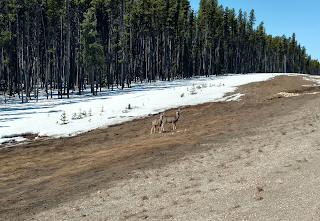
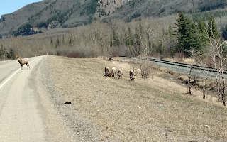
We left Jasper on Highway 16 and headed out of the park. The highway follows the Athabasca river. While still in the park, we spotted elk (wapiti), bighorn sheep and deer. We picked up Route 40 about 6 miles from the park and headed north towards Grande Prairie. This part of 40 runs through Spruce and Pine forests, with only one town (Grande Cache) about half way between Jasper and Grande Prairie.


Elk
Bighorn sheep
Deer
We decided to stop at the Grande Cache visitor center where we were greeted by the manager. He was a fount of information abut the area: the town is at an elevation 4000 feet, there's a small protected herd of 40 caribou, the town was established for coal mining and the fishing is great. We told him we saw caribou coming into town and his response was 'you're very lucky to have seen any!' He hadn't seen any for 3 years.
Athabasca River
Caribou from Grande Cache herd
Grande Cache Caribou

From Grande Prairie, we turned West on Route 43 headed to Dawson Creek - Mile 0 of the Alaska Highway. We were leaving the mountains and returning to flatter land as we drove towards Dawson Creek. Most of the vehicles we saw on 43 were commercial; servicing lumber and natural gas facilities. The gas drilling rigs stood above the trees and were easily spotted by looking for the gas flares.


We pulled into Dawson Creek and parked at the visitor center. As we were walking up the path to the door, someone came out and changed the sign from 'open' to 'closed'. Sheesh....

So we drove up 43 a bit and found a campground where we paid for a site. The campground was just a flat, open space with hookups for trailers and a howling wind. We setup the stove and cooked dinner in 20 MPH wind with gusts that felt like 30 MPH! It was delicious!


Day 11, Sunday, 4/29/18
3131.7 miles
Jasper National Park, Alberta, Canada


After the crowds and busyness of Banff, it was nice to head into the wilderness. On the way out of town, we stopped at the Cave and Basin National Historic Site. A cave with hot springs was found by 3 Canadian Pacific Railway workers in 1875. They later tried to claim the area but the Canadian government stepped in and appropriated it and some surrounding land. This is the birthplace of Canada's national parks.

There's a small hot spring along a walking path up Sulphur Mountain. It's the only known home of a small (the size of a popcorn kernel) snail called the Banff Spring snail.

Home to endangered Banff Spring snail
Hot spring flowing out
The Basin
Wildlife Corridor
Leaving Banff on Route 1, there are what look like overpasses but are really wildlife corridors allowing animals to move freely across the highway. Last time we were here with Di and Bill, they were all over the highway!! Deer, Elk and Caribeau

Route 1 passes near Lake Louise so we decided to check it out. We had hoped to see Lake Moraine but the road was closed. It's a short drive up to the lake and the first thing you see is the Chateau, an old railroad destination for those bold rusticators from New York, Philadelphia and Boston.

Chateau Lake Louise
Still lots of snow!
Lake Louise at the end of April

In spite of the sign saying 'Thin Ice!', people were still wandering on to the lake. One particularly hearty soul decided to walk right up to the edge of the ice where he started to sink into the slush. Hope he doesn't have any kids...

Things are looking up!
Can you spell 'idiot'?
From Lake Louise, it was off to Wapiti campground near the town of Jasper via Highway 93, also known as the Icefields Parkway. It winds its way along the Continental Divide through some of the peaks in the Rockies, past glaciers and icefields. This road is impressive. The highest point is 6,785 feet at Bow Pass. Driving 93, you're surrounded by mountain peaks, some with great names: Noseeum Peak, Mosquito Mountain, Mt Weed. There are visible avalanches on both sides of the road here. It is a high mountain pass where we experienced snow squalls and the signs all say keep your chains on!!There are quite a few campgrounds, though I think I'd stay away from the Mosquito Creek Campground!

Just past Wilcox Peak is the Columbia icefield. An icefield is made up of interconnected glaciers. Across the street from the Athabasca glacier is the Glacier Discovery Center. This is operated by a commercial company called Pursuit. In spite of the cloudy weather with poor visibility, the parking lot was full of tour buses. Pursuit offers trips on the glacier in modified buses. They also have this thing called the Athabasca Glacier Skywalk. The skywalk is a few minutes from the discovery center and not visible from the road, so we didn't get to see it. From the pics, it's an impressive looking piece of engineering. Very commercial.

The discovery center has a large deck overlooking the glacier. Even though the clouds were low and the wind was howling, we managed to catch a view of Athabasca. Back in the center, we bought an over-priced cup of coffee and got back into the van.

About an hour up the road, we saw this amazing 4-legged creature called a grizzly bear - welcome to Jasper! (Interesting fact: Jasper is the world's largets dark sky preserve.) Shortly after we turned into Wapiti campground for the evening.  The word 'Wapiti' has it's roots in a First Nation word 'waapiti' which has it's roots in the word 'wap' meaning white. So what we call 'elk' is really a 'wapiti'. The name is very descriptive - identify a wapiti by its white butt, which is what 'wapiti' means.

This was a really nice campground, and it was really cold out. The walk to the river is beautiful! The facilities are heated with hot showers and hot bathrooms to get dressed in. but cooking breakfast was cold!! Lots of people around us here.

The most remarkable is the Jurassic park car with a fold out tent mounted on top. There is a little ladder to get up to the flap!!


We are sharing the driving equally and will spend the next 4 days in the car!! To get to Alaska.


Heading NW to Jasper 
Bow Lake
Embraced by the Rockies
A beautiful gray day
Columbia Icefields
Tourists blocking the view!
Grizzly!

Driving the Icefield Parkway I was reminded of the Lewis and Clark expedition. Both men had trouble re-integrating into civilization, particularly Merriwether Lewis who had a drinking problem and probably committed suicide. After almost 2.5 years packing through the American wilderness, I can imagine how difficult it must have been getting used to the bustle of a city. We just downloaded a book on the expedition through Audible and will be listening as we drive.

Day 10, Saturday, 4/28/18
0 miles
Banff, Alberta, Canada


The morning was sunny and warm. Just before breakfast I noticed a shuttle schedule to Sunshine Valley. This is a ski area and still open for spring skiing. After waffling for a bit, Chris and I decided to spend the day apart; she walking and hiking around town and I going snowboarding. I rented a board and boots and hopped the shuttle to Sunshine Valley.

It was indeed spring weather! A bit icy before noon, turning to slush later in the afternoon. By 4 o'clock, the snow was really sticky. On the last run, I had to take the board off and hike downhill to a steeper slope just to get back to the lodge. All in all, a very good day.


Style-conscious, waiting for the bus
View from the gondola
On the mountain

Day 9, Friday, 4/27/18
2,952.7 miles
Banff, Alberta, Canada


We left Elkwater this morning for Banff, Alberta. Having underestimated the rigors of life in a van, we decided to stay in Banff for a few days - in a hotel with a hot tub, hot showers, indoor plumbing and heat! This proved to be a good move.

Banff is a community squeezed between the beautiful peaks of the snow covered Rockies. After driving so many days in a row, our goal was to walk around a bit!!

Banff is heavily commercialized and a tourist hot spot. While a draw for people around the world, we noticed there was quite a large contingent of people from Japan. It seems that package tours to Canada from Japan are very popular. If a large number of tourists were from Japan, the commercial venues (hotels, restaurants, gear rental, etc) all had staff from Australia.

After an early dinner, out on the Saltlic deck, it was off to bed.


Still in the Plains
The Canadian Rockies
Getting close
Downtown Banff

Day 8, 4/26/18
2,643.3 miles
Elkwater, Alberta, Canada


We left Medora, ND this morning and headed west on I 94 into Montana, then north and west on 13 to 2. The largest town we passed through was Havre, MT about 49 miles from Wild Horse, AB where we crossed over into Canada. On the way, we drove through small towns with names like Saco, Sleeping Buffalo and Harlem. A number of these were Indian reservations. It looked like hard times in this part of Montana.

The scenery in western Montana to today's destination (Elkwater, AB) is much the same: prairie and grassland - the Great Plains. The plains don't know anything about the US/Canada border. It's easy to see that these artificial constructs aren't really connected to the land and that the plains will will still be here long after the borders are gone.

Typical

Elkwater is in the first and only interprovincial park called Cypress Hills. A 'geological anomaly', it's almost 2000 feet higher than the surrounding prairie. Coming into Elkwater, the landscape changed from flat, grassy prairie to spruce covered hills. There's also a mid-sized lake in Elkwater called  (you guessed it) Elkwater Lake. There was a sign just before the visitor center telling us to be 'cougar smart'. Apparently, there are cougar in these parts. And of course, Elk.

The campground we stayed in had probably 8 or 9 large RVs, one tent and one van. It surprised us with a heated building containing flush toilets and hot showers! Deer wandered through the sites and on the roads apparently accustomed to human activity. Prairie dogs, geese, magpies and crows were also comfortable around people. While cougar sightings are rare, they're probably attracted to the somewhat tame deer and food left behind by campers. Just after we woke up, a large crow landed on the passenger side window and looked inside. It was a good thing the window was closed!

Deer at the Cypress Hills Visitor Center

It was just luck that we snapped this picture as we were about to pass over the mysterious markings on the road. Strikingly familiar to the pictographs in the Sego Canyon cave paintings. Clear evidence of  extraterrestrial visitations!

Mysterious markings
Zaphod Beeblebrox was here!

Day 7, 4/25/18
0 miles
Theodore Roosevelt National Park, ND


Today was a great day. I think we're starting to get into a rhythm of travelling and living in the van; a good night's sleep to begin with. Waking refreshed, we made coffee, had a leisurely breakfast then took a ride to the visitor center.

At  the visitor center we learned that even the native Americans did not like the Badlands. The Lakota called it "mako sica" or "land bad." Named so because they could not support the cattle or crops. The badlands are at the top of the great northern prairie lands. Hills of eroding sand stone and scrub juniper, and cottonwood trees. This time of year, all the vegetation is brown!
The baby bison are born in April. Hope to catch a peek at a young one.

Ironically, it turns out that Teddy Roosevelt hired two guys from Maine (William Sewall and Wilmot Dow) to build and run Elkhorn ranch.


We took the scenic loop drive (about 32 miles) for an amazing tour of the badlands. Bison, wild horses, prairie dogs, deer and even cactus.

There's a desolate beauty to the Badlands. The butte grasses were dry, gold yellow to brown. The only green were the juniper trees.


Day 6, 4/24/18
2,175.6 miles
Theodore Roosevelt National Park, ND


We arrived at the park around 5:00 pm Mountain time. A longish drive, the topography from Minnesota to North Dakota is similar to that of western Illinois and Wisconsin. Flat with a few rolling hills, mostly what looked like corn fields and an increase in cattle herds as we headed west.

The National Parks Senior Pass got us into the park with a 50% discount on the camping site: a whopping $3.50 per night! Driving in, we saw deer, wild horses and scores of prairie dogs. The turnoff to the campground was blocked by bison (buffalo), so not knowing what to do we kept on driving.

After a bit, we turned around and drove slowly through the group. Apparently, they're used to cars and slowly moved out of the way. The site we have is right next to a river, the Little Missouri. Lots of cottonwoods and birds in full voice. As the sun set behind the buttes along the river and night settled in, it was dinner under a half moon. And as the night turned colder, we were left wondering why we left Maine to head for Alaska instead of someplace warmer! :)

Tomorrow, we stay in the park to explore and play.


Day 5, 4/23/18
1,629.7 miles
Maple Grove, MN

We left the Corriveau homestead in Somonauk this morning at about 7:45 AM with the idea of driving about 6 hours or so ending up in Maple Grove, MN at a KOA campground. This is about halfway between Somonauk and Theodore Roosevelt National Park - our next stop. We drove through Wisconsin on I 94 doing 70 mph. Pretty hard to see anything at that speed. There were more water features in Wisconsin and even a few signs for ski areas (Granite Peak ~ 550 meters elevation).

The Campground
The First Supper
"Oh, that uh, that there's an RV."

This was the first time we broke out the stove and cooked dinner. It's also the first night we got to sleep in the van. 

Day 4, 4/22/18
0 miles
Somonauk, IL


Morning poked its head through the window, sunny and promising 60F + temps. Perfect weather for cutting holes in a van roof! I drilled 4 holes from the inside, one for each corner of the fan to mark the cut lines. A plastic bag was taped on the inside to catch the metal from the cutting wheel. The hole in the bag is where Mike pushed up the cut square of the roof so I could grab it.

The outside edge of the hole was masked to prepare for caulking the fan. Note the 2 dark rectangles in the depression. These are pieces of hard rubber used to create a flat surface for the fan to sit on.


Marked for cutting
The dirty deed done!
Ready to caulk
We also added an airfoil to the front bar of the roof racks. It cuts down on the noise when travelling over 55 mph.

Paul-in-the-box
With Mike's help, the finished product.
Installing the airfoil