Day 43, Thursday, 5/31/18
Fort Nelson, BC


It was cold when we woke up, so we decided to warm up in the springs. There were only a few  people about this early giving us the run of the pool. This was a great way to start the day! After breakfast, we started making our way to Fort Nelson, about 300 miles away, leaving the low hills and broad plains of the Liard Basin ecoregion to begin our crossing of the Canadian Rockies. Spectacular mountain views and less snow than a month ago. Still so beautiful!

Early Morning at the Spring
Starting the Climb 
Rockies in the Distance
We passed a number of hiking spots into small canyons. Each trail starts at an alluvial fan immediately off the ALCAN. While it looked dry, a sign at one of the hiking spots said the hike was best done in the fall when water levels are low. The trails lead over berms created to keep water coming out of the mountains from flooding the road.


Alluvial Fan
Another
One More
As we neared Muncho Lake, we spotted a few Stone sheep. The males (rams) have large, strongly curved horns while the females (ewes) have smaller, straighter horns. Stone sheep range further north than their Bighorn cousins.

Stone Sheep
Stone Sheep Ewes
Stone Sheep Ram
Continuing south, we arrived at Muncho Lake. This is where a truck carrying plywood rolled over into the lake. Twenty nine days later, there was no sign of the accident (and no plywood to salvage!)

Muncho Lake
Muncho
ALCAN Along Muncho
We picked up Toad River just before leaving Muncho lake Provincial Park. There are hot springs on the river but access is limited to hiking, by air or water and bathing is not recommended. The springs are part of a provincial park. Needless to say, we didn't check it out. We saw a few more sheep and Chris spotted a moose in the brush off the road.

Moose Checking Us Out
Toad River
Toad Rivert

The ALCAN has a deservedly notorious reputation. We found the road to be in good shape but there are sections where it's a bit hairy.


We spotted a couple of black bears on the side of the road.

Black Bear
All along the way, there were RV's and campers heading north, probably one every 5 - 10 minutes. On a section of road that was being worked on, a truck heading north threw up a small rock that dinged the windshield. This was the one and only issue we had on the entire trip. Pulling into Fort Nelson, we found a shop that did a quick repair to the 'rock chip'. These are pretty common. (We saw quite a few vehicles with full width cracked windshields in Alaska, the Yukon and BC.) Glad we fixed ours before it spread!!


Day 42, Wednesday, 5/30/18
Liard Hot Springs, BC


We left Teslin headed for Liard Hot Springs in BC. It was a bit chilly when we left but warmed up fast to the point where it was actually hot! It's the time of the year, cold at night hot when the sun gets up high enough.

On the way to Liard, we spotted bison, a few with their  calves.

Other critters along the road: a porcupine ambling along the roadside, a moose running across the road, another moose off to the side, swans and ducks.

It's about 300 miles from Teslin to Liard. The highway follows Rancheria River for a bit then on through the Liard Basin ecoregion - an area of low hills, broad plains with extensive stands of boreal forest (mostly lodgepole pine, spruce and aspen) surrounded by mountains.

Not far from Watson Lake we left the Yukon and entered British Columbia where we picked up the Liard River and followed it to Liard River Hot Springs Provincial Park where we planned to camp for the night. After settling in, we took a walk to the  springs. Halfway there, the clouds got really dark and it started to rain and thunder so back to the van to wait it out.

When the storm had passed we set out again, bathing suits and towels in hand. There's a boardwalk over a swamp to the pool. The swamp water is warm and we noticed small fish swimming back and forth under the boardwalk. These are lake chub and are of interest in that they can survive the swamp's warm waters.

Duck in Swamp
View From Boardwalk
View From Boardwalk
The Liard hot springs are unique. Unlike many other hot springs that flow into creeks or rivers, these flow into a system of swamps creating a micro climate housing species not found in surrounding areas (for example, 14 types of orchids). The vegetation is lush and thriving. The heated water coming back up to the ground contains dissolved calcium carbonate which forms into porous rocks called 'tufa'.

Ferns
Changing Rooms and Pool
Steam Rising
A Second Pool
Hanging Garden Formed by Tufa
Arriving at the pool, we changed into our suits and waded in. The water temperature varied depending on where we were relative to the pool's feed. Close to the feed, the temperature was around 126 F. Near the opposite end, the temp was somewhere around 108 F. Very nice!

There's another pool nearby but permanently closed off due to black bear activity. As in so many other places in this part of the world, bears are everywhere and we carried our bear spray. In any walk through the woods, the goal is to avoid surprising or being surprised by a bear. By making noise, a bear is warned that there are people around and will usually leave the area. Bear spray is a tool of last resort, used when an attack is imminent. Fortunately, the only bears we saw were from a distance, while in the van.

One downside to the warmth was our re-acquaintance with mosquitoes! 

Day 41, Tuesday, 5/29/18
Teslin, YT


It was a bit of a gray morning in Skagway, with four cruise ships already docked. Chris decided to check out the museum and I took a hike up to and around Lower Dewey Lake. It's a short hike, about 5 miles with an elevation gain of 500 feet. The start of the trail was clogged with people from the boats but thinned out considerably near the start of the loop around the lake.

petroglyph?
As I walked up the path, I noticed a carving in the rock face. The carving is similar to other Tlingit petroglyphs showing a human face (here, bottom). It looked like it had been there awhile, but no idea how long.

Along the south side of the lake were remnants of a railroad track. Coming back down, the trees opened up, providing a good view of the harbor.


Lower Dewey Lake
Abandoned Tracks
Skagway Harbor
The Museum contained a variety of artifacts and stories from the gold rush days and stories of the prospectors climbing the trails and passes to get to the gold!! It also highlighted the area's history of the trade routes of the Chilkat Tlingit First Nation people.

After the hike, I met Chris at the Skagway library. Walking back through town to the van was like navigating rapids - people everywhere! Back in the van, we hightailed it out of town back to the Yukon.

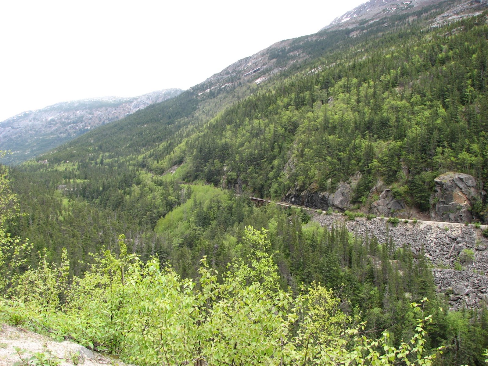
Things always look different going over the same road but in the opposite direction. Driving into Skagway we were focused ahead, not where we'd come from. The modern mountain pass road through White Pass (finished in 1978) roughly follows the path taken by the stampeders during the Klondike Gold Rush. A stampeder was required by the RCMP to carry a year's worth of supplies, probably close to a thousand pounds of gear and food. Arriving in Skagway and facing the pass must have given more than one prospector second thoughts!

White Pass
White Pass
White Pass and Yukon Route Railroad
The landscape just beyond the top of the pass (~3300 feet) is rugged and still had snow. Except for the snow capped mountains, it reminded me of Acadia's rocky landscape. The Emerald lake stretched on to the right for miles.

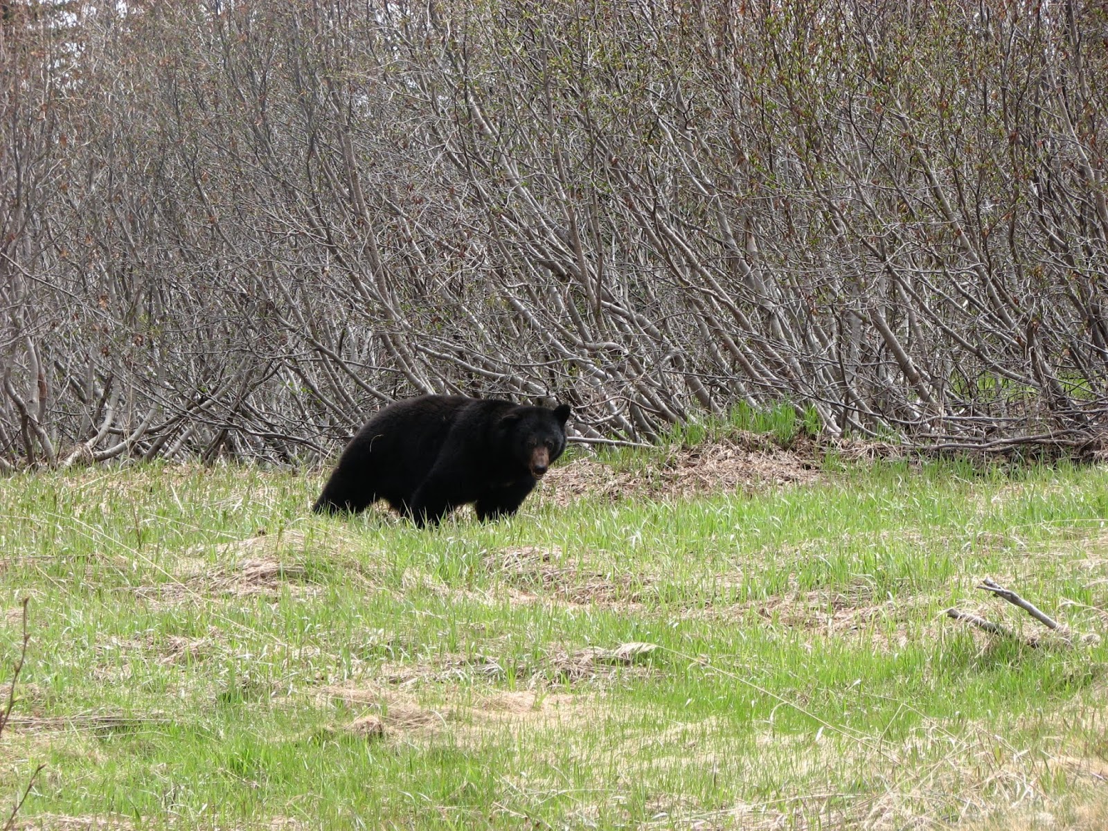
Just past Canadian customs, we spotted a black bear on the side of the road. We were far enough away when we stopped that it didn't appear to notice us, though that may also be because it's been habituated to cars.

Between White Pass and the town of Carcross, the road follows Tutshi and Bennett Lakes. Bennett was where the Chilkoot Trail ended and the stampeders left land headed for the Yukon River via water. Both Tutshi and Bennett are large lakes, approximately 22 and 50 miles respectively. The White Pass and Yukon Railroad runs along Bennett and some of the smaller lakes.

White Pass and Yukon Route Railrtoad
Back on the ALCAN, we crossed the Teslin River at Johnson's Crossing (population 15) and then southeast along Teslin Lake. The views, of course, were lovely.

Wild Flax
Still Cold!
In Teslin, we stayed at Yukon Motel and Lakeshore RV Park. We found a nice site at the back of the park, right on the lake. We watched the full moon rise while the midnight sun would not give way to the night!! Teslin is home to the Teslin Inland Tlingit First Nation. In Canada, the term 'First Nation' replaced the term 'Indian Band'.