Day 40, Monday, 5/28/18
Skagway, Alaska


The Road to Skagway
It was a bright, blue bird sky morning. so we decided to drive to Skagway, AK. Our last stop in Alaska, it's about a hundred miles from Whitehorse, an easy ride. Highway 2 (Klondike Highway) runs through the Yukon, then into British Columbia, then into Alaska where it becomes Rt 98. Along the way it runs through river valleys dotted with  glacier fed green lakes, skirting mountains on each side.


About 6 miles from Carcross, YT we came across a lake that was absolutely stunning, Emerald Lake. In the sun, the lake almost glows with layers of blue, blue/green light. The color comes from deposits of lime-rich mud (marl) on the bottom reflecting the light.

Emerald Lake

Just south of the lake is what's called a desert, Carcross Desert. This was once the bed of a glacial lake and is now a square mile of sand dunes. The desert is also home to a few rare plants like the Baikal Sedge, usually found only near Lake Baikal in Siberia. Apparently the Canadian government tried to protect the desert but failed due to local opposition. Check out the tire tracks in the pictures below.

Carcross Desert
We don't need no stinking sedge!
Leaving Carcross, the highway follows Tagish Lake. This is a pretty big lake, almost 62 miles long and sitting in both the Yukon and BC.

Bove Island.
Near the north end of the lake is a large island, Bove Island. Remember Schwatka (here)? He named the island after a lieutenant in the Italian navy. He also called the lake Bove. Fittingly, the name was changed to Tagish Lake after the Carcross Tagish First Nation.

The Tagish area is surrounded by the Coastal Mountains.


Coastal Mountains


Black Bear
With winter behind  there was a lot of road construction, the Klondike Highway no exception. We were stopped by a guy holding a 'stop' sign in one hand and bear spray in the other. He came over to chat (pretty common in Alaska and the Yukon). Pointing back to the side of the road, he said 'See my friend?' He was sticking close to his truck.

The vehicles lined up and we waited for the oncoming traffic to end. The way it works in both the Yukon and Alaska is that a 'pilot vehicle' leads the traffic into the work area, making a u-turn at the end to pick up the traffic waiting for their turn.


Just before the BC/Alaska border we entered White Pass. During the 1897 - 1899 Klondike gold rush, stampeders had a choice of two passes to get to the Klondike: Chilkoot Pass and White Pass. The White was heavily advertised as the best way to the gold claims by steamship and other companies looking to cash in. Even though it wasn't as high or steep as the Chilkoot, it turned to mud in late summer/early fall and became impassable. It's claimed that over 3000 horses died on the White Pass Trail, thus earning it the nickname 'Dead Horse Trail'.

The White Pass

It was early afternoon when we pulled into Skagway. We parked the van in the Pullen Creek campground, owned by the town. At $45 a night for a tent site, it was a ripoff. It looks like the whole town exists because of tourists, most coming by large cruise ships. There were two when we arrived, with four scheduled for the next day - over 10,000 people roaming the streets. So, gouge when the gouging is good.

We took a walk through town and had dinner at a Thai restaurant. The food was good and the price reasonable. Back at the van, the wind was howling. The name 'Skagway. has its roots in the Tlingit language meaning something like 'big seas driven by fierce winds'.
An interesting point, Seward, Valdez and Skagway all have harbors, but the open ocean is not visable from any of these cities. The coast is so mountainous that the sea does not show! Just mountains!!

Day 39, Sunday, 5/27/18
Whitehorse, YT


We slept in today. After a breakfast of coffee and bagels, we left the B&B to explore Whitehorse. While putting a few things away in the van, Dave, a friend of Pam's ( owner of the B&B) came out and commented on how far from home we were. We chatted a while and he gave us a few suggestions about what to see in Whitehorse.

Our first stop was the Whitehorse Rapids Dam. There's a fish ladder that the salmon use when they spawn, but we were too early in the season to see any salmon. Behind the dam is a lake created by  damming the Yukon River, Schwatka Lake. Frederick Schwatka was a US cavalry officer and in 1883 was sent to scope out the Yukon River by the army. Along the way, Schwatka named just about every landmark after people he knew, apparently in the hopes of currying favor. The 1883 expedition was sent without informing the Canadian government, an alarming event that spurred the setting of the border between Canada and the lower 48.

We left the dam and took a ride on Chadburne Lake Rd, which winds its way along Schwatka Lake for a bit then heads off to Chadburne Lake. It's a dirt road and at one point was crowded with kids on their mountain bikes.

On our way back on Chadburne, we stopped at a high point overlooking Whitehorse. We continued to the visitor center, parked the van and took a walk along the river. The  clouds were coming in and it looked like it might rain. It being close to 1 PM, we went into a small cafe for some food and a WiFi connection. We got the food, not the WiFi. While we were inside, it started to hail! No, still not spring yet!

Whitehorse, looks like rain
Hail

Our next stop was the MacBride Museum. As we were walking in, Jim and Melanie were walking out. I showed Jim the picture of what I thought was a lynx and he agreed, even though this particular cat didn't have the characteristic tufts on its ears. The MacBride is a pretty nice museum. There's a display of most of the wildlife (stuffed) found in the Yukon.

Gas Pump, ALCAN Style
There's also a history of the ALCAN, its early days pretty much summarized by this anonymous ditty:

"The Alaska Highway, Winding in and winding out,
  Fills my mind with serious doubt,
  As to whether the lout that built this route,
  Was going to Hell or coming out!"


The museum also has a few outdoor displays, one being panning for gold practice and instruction! Another is Sam McGee's original cabin. It's of note because of a somewhat famous poem by Robert Service, the fictionalized 'The Cremation of  Sam McGee'

It was a good day in Whitehorse. We went to a supermarket for supplies, then went back to the B&B for a light salad dinner and to do some work on the blog.


Day 38, Saturday, 5/26/18
Whitehorse, Alaska


We woke to beautiful day, blue sky and just a few clouds. Getting ready to leave consisted of putting the 5 gallon water container back in the van. About 35 miles from Lake Creek, after seeing nothing but trees and water, we ran into the Pine Valley Bakery and Lodge. This is a small oasis specializing in crepes. We went in and ordered coffee and cinnamon buns. While we sat there, another couple came in and we started to talk. Jim and Melanie were on their way back from a 2 week hunting trip in the Alaskan bush. They were out there so Melanie could bag her a bear. And she did. They had planned and prepared for this trip for a year! We saw pictures of the grizzly she shot.

Lynx Keeping an Eye on Us
As we left the creperie, I noticed something crossing the road in the distance. So we slowed down and pulled over. The animal turned out to be a lynx. It sat down on the edge of the road and looked at us as we looked at it. This was the first and only lynx we saw on our trip. (Notice there is still snow on the roadside here  and we're on our way back, but spring just won't start!) We loved this area, as the Wrangell-St. Elias mountains are still tall, snow covered  and beautiful here.


We drove past Kluane River on our way to Haines Junction. The Kluane was an important route and hunting ground to the First Nations in the area.

Approaching Kluane Lake, we stopped at a small visitor center just below Sheep Mountain, so named because it's the home of a small group of Dahl Sheep. Some of the ewes had lambs, though they were a bit hard to see at our distance.

Dahl Sheep
Kluane Lake has an interesting history. It's main source of water for hundreds of years was the Slims River which in turn was fed by the Kaskawulsh glacier. Over the course of 4 days in 2016, the Slims disappeared. It originally joined the Kluane which flowed north into the Yukon River emptying in the Bering Sea. Because of extreme melting, the retreat of the Kaskawulsh changed the direction of flow of its melt water into the Kaskawulsh River, flowing into the North pacific ocean. The level of the lake has dropped over a meter and may continue dropping. The ALCAN once crossed water. Now it crosses a dry lake bed.

We made our way to Haines Junction and took a left to continue on Highway 1 to Whitehorse. Along the way, we spotted a few elk.


After settling in Pam's B&B, we had dinner at Klondike Rib and Salmon, a fixture in downtown Whitehorse. Originally a tent frame structure built in 1900, it went through a few incarnations before becoming the restaurant. According to Pam, this is one of the spots the locals eat at.

Day 37, Friday, 5/25/18
Lake Creek Campground, Alaska


After spending the night at Young's Motel we had breakfast at Fast Eddy's, mile 1313 on the ALCAN. About 80 miles from Tok to the Canadian border, we crossed over the Tanana River into the Yukon. The Tanana flows in a northwest direction and feeds the Yukon River.


Rivière Tanana


The Canadian customs stop is just outside Beaver Creek. There weren't any cars ahead of us, most of the traffic heading in the other direction. The June rush to Alaska is on! The custom agent was pretty relaxed, asked us a few questions and sent us on our way with a 'Enjoy your trip!'.

We stopped at the visitor center in the Tetlin National Wildlife Refuge. (While the sign said 'Tetlin', it's really Kluane National Park in Canada - go figure.) The refuge shares a border with Wrangell-St. Elias National Park. It's a diverse landscape consisting of forests, lakes, tundra, wetlands and glacial rivers.

Behind the visitor center and a short walk downhill are two cabins that were used by trappers passing through the area. The cabins are slowly sinking into the ground. Halfway down the hill, there was a 'Caution! Bears in are!' sign attached to a tree. Of course, just a few hundred feet from the sign was a pile of fresh bear shit. We continued down the path making a lot of noise, bear spray in back pocket.

Continuing east, we started seeing the mountains of the Saint Elias Range.


We made camp at the Lake Creek Campground. Of course, it's on White River... Lake Creek Campground is a Yukon government site and pretty much in the middle of nowhere on the ALCAN. When we set up, there wasn't anyone else there and the only unnatural sounds were the occasional passing of a vehicle. A few people drove in then out, probably just looking around. Later that evening, a camper and a motorcyclist showed up.

It was a nice site right on the river bank with views of the Saint Elias mountains. The birds were hanging out, looking for a free meal.

Is That Van for Sale?
What's for Dinner?
Hey Guys, Free Lunch!
Mine, No Mine!

Day 36, Thursday, 5/24/18
Tok, Alaska


Today, we woke early to tour around Valdez. We walked the docks in the small boat harbor, then borrowed Glen's truck and drove out to a small beach about 2 miles west of town. It was a short walk to the beach (bear spray in the back pocket and occasionally yelling 'yo bear!') The beach looks out to the mountains that surround Valdez and the port. Though we didn't see it, there's a large glacier further west that once terminated at tidewater in Shoup Bay. It's retreating and is currently over a mile from the bay.

Small Boat Harbor
Rocky Beach
Surrounded by Mountains

From the beach, we drove back into town and stopped at the Valdez Museum. The museum has an interesting history of the 'Gold Rush of 1898'. It was a hoax promoted by steamship companies that drew over 4,000 people to the area. The museum also had an exhibit about the Good Friday  earthquake that hit Alaska in 1964. The town was destroyed by both earthquake and a series of and seiches (waves). Because the ground was deemed unstable, it was moved to a new location.

Back at the Potato, it was a bitter sweet moment as we said our goodbyes to Glen and the staff and left for Tok. It was time to start working our way back to Maine.

For the last time (this trip), it was over Thompson Pass. and Richardson Highway.

In 2014, there was a massive slide east of the town in Keystone Canyon that put 50 feet of snow and debris in the road. It also blocked the Lowe River forming a large ice lake. Dubbed the 'damalanche' by locals, the town was cut off from the Richardson Highway (only road in or out of Valdez) for 13 days.

Thompson Pass
Brrrr.....
View of Copper River (I think)

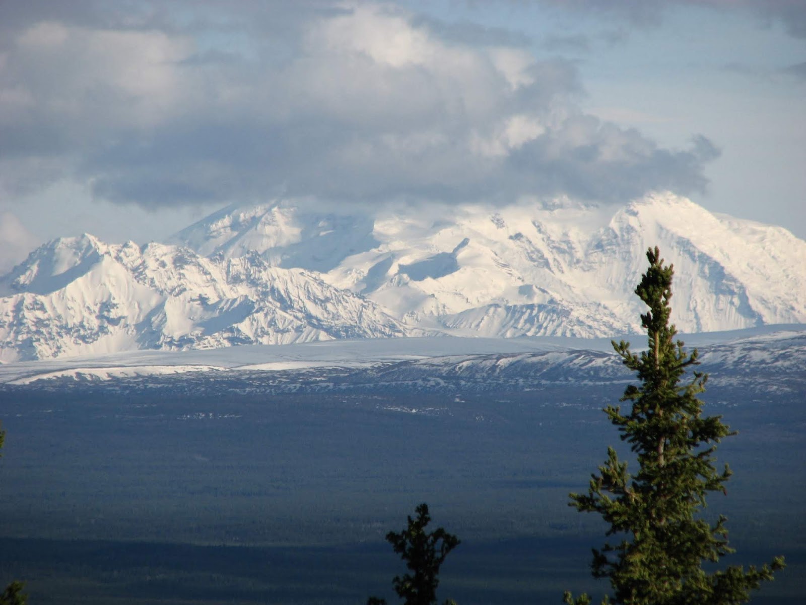
We weren't planning to go to Tok, but ended up there anyways. On the way, there were great views of the Wrangell Mountains!